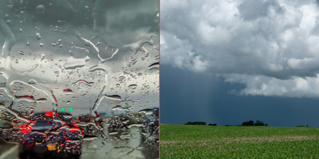
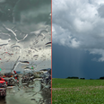
Following the news that we are planned to get “abnormally hot” weather over the next couple of summers in Ireland, that has been doubled with the announcement we are set to be hit by Storm Ernesto.
Storm Ernesto will bring with it a ‘Post-Tropical Cyclone’ and we are expected to at least get the tail-end of the Subtropical Storm which has formed out in the Atlantic.
Subtropical Storm Ernesto has formed out in the Atlantic, it is expected to become a
post-tropical cyclone Thursday night or early Friday. The track will see it head for Ireland Saturday night but at present it is forecast very breezy with some rain. pic.twitter.com/flJ7Pl6iRw— Carlow Weather (@CarlowWeather) August 15, 2018
Forecast wind and rainfall for Saturday night from remains of #Ernesto pic.twitter.com/cm5vmnxNEl
— Carlow Weather (@CarlowWeather) August 15, 2018
The storm is a newly named by the US National Hurricane centre and has already reached maximum sustained winds near 40 mph with the possibility of additional strengthening over the next few days.
It is centered around 695 miles southeast of Canada and it is feared that it could grow into a major hurricane by Saturday.
For the moment, Met Éireann are saying that Saturday will be quite warm and humid, but changeable and unsettled.
There is the possibility of rain and drizzle at times with it becoming more widespread on Saturday night.
Topics:
RELATED ARTICLES


MORE FROM Lovin Dublin


MORE FROM Lovin Dublin