This is now heading in the same extreme path that Ophelia and the Beast From the East did.
The weather warnings are coming thick and fast and Met Éireann has even issued a scary “risk to property and life” statement.
At 7pm, they issued three separate Orange Wind warnings for various counties across Ireland.
Storm Callum will hit Cork, Kerry (both of whom were in the first warning), Donegal, Galway, Mayo, Sligo and Clare (all of whom were in the second warning) and “Southeast winds veering southwest will gust generally between 100 and 130km/h, higher in some coastal areas and on high ground. Along with a spell of heavy rain and high tides there is a risk of coastal flooding and damage.”
The warning for Cork and Kerry is valid from Thursday 11 October 2018 22:00 to Friday 12 October 2018 09:00.
While the warning for Donegal, Galway, Mayo, Sligo and Clare is valid from Friday 12 October 2018 00:01 to Friday 12 October 2018 13:00
As well as this, Dublin, Louth, Wexford, Wicklow, Meath and Waterford also have an orange winding warning which says Storm Callum will bring South to southeast winds of between 100 and 130 km/h, strongest at the coast. There will also be spells of heavy rain, high tides and coastal flooding.
The warning for those counties is in place from Friday 12 October 2018 00:01 to Friday 12 October 2018 09:00.
In a statement, Met Éireann said that:
“An ORANGE level warning is issued by Met Éireann for wind speeds with the capacity to produce dangerous, stormy conditions which may constitute a risk to life and property.
- Stay away from exposed coastal areas for the period of the ORANGE warning.
- Drive to anticipate strong cross winds and other hazards such as falling/fallen trees. High sided vehicles and motorcyclists are particularly vulnerable to strong winds – slow down and give extra space to pedestrians and cyclists.
- Be aware of local conditions in your area; wind strengths can vary significantly from place to place (depending on direction and local topography).
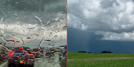
“Storm Callum is the 3rd named storm of the 2018/19 season. Not yet formed, but later Thursday into early Friday, a rapidly deepening Atlantic storm depression (936hPa), will advance towards the west of Ireland and track northwards, eventually pulling away towards Iceland daytime Friday.
“The strongest winds associated with this event will occur during the night-time hours and Friday morning rush-hour commute. Even though the high winds will be the main concern, a spell of heavy and possibly thundery rain will occur too, making for an extremely windy and wet start, with squally conditions associated with the secondary cold front as it tracks north-eastwards up across the country. Possibly damaging and disruptive southeast winds will veer southwest after the passage of this front, with the strongest of the winds set to impact coastal areas.
“Additionally there is a concern for storm surge, coastal flooding, and overtopping of waves around coasts, especially Atlantic coasts, due to the coinciding high spring tides. Very high seas are expected too, along with storm and possibly violent storm force winds at sea. With trees still in part leaf, there is a concern for felling as well.
“Though the winds will ease down by late morning/forenoon, a sting in the tail will follow, with a deterioration likely again later, as the trailing waving weather front potentially feeds up further pulses of heavy rain from the south, with the possibility of a further core of severe southerly gusts for south, southeast and east coasts towards evening. Elsewhere, however, the winds should remain below warning thresholds.”
Be careful out there, folks.
READ NEXT:This Dublin Hotel Has Been Named The Best In Ireland By Condé Nast Traveller
Topics:
RELATED ARTICLES


MORE FROM Lovin Dublin


MORE FROM Lovin Dublin